Visual Materials
Big Creek, Fish Valley - Fish Creek Project

You might also be interested in

Big Creek, Fish Valley - Fish Creek Project
Visual Materials
Big Creek, Fish Valley - Fish Creek Project - Lower area of left abutment at Fish Creek Damsite viewed from top of right abutment.
photCL SCE 02 - 29171

Big Creek, Fish Valley - Fish Creek Project
Visual Materials
Big Creek, Fish Valley - Fish Creek Project - Right abutment at Fish Creek Damsite viewed from left abutment.
photCL SCE 02 - 29169

Big Creek, Fish Valley - Fish Creek Project
Visual Materials
Big Creek, Fish Valley - Fish Creek Project - Looking West along canal Southeast of Knob south of Onion Spring Meadow.
photCL SCE 02 - 29162

Big Creek, Fish Valley - Fish Creek Project
Visual Materials
Big Creek, Fish Valley - Fish Creek Project - Looking South across Sharptooth Creek at Sharptooth Peak from saddle where trail crosses ridge between Sharptooth and Fish Creeks.
photCL SCE 02 - 29167c
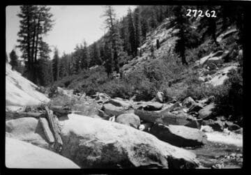
Big Creek, Fish Valley - Upstream - Fish Creek from Station 1003+70
Visual Materials
Big Creek, Fish Valley - Upstream - Fish Creek from Station 1003+70 - 600' downstream from proposed damsite.
photCL SCE 02 - 27262

Big Creek, Fish Valley - Fish Creek Project
Visual Materials
Big Creek, Fish Valley - Fish Creek Project - Looking down manzanita slope (morainal) to location of canal, about 1 mile Southeast of Onion Spring Meadow. Canal location believed to be near trees at location of slope.
photCL SCE 02 - 29164